

Jones & DeMille Engineering led the mapping and survey effort for the Rural Utah Infrastructure Coalition (formerly the Seven County Infrastructure Coalition) on its Uinta Basin Railway Environmental Impact Statement (EIS), one of the largest and most comprehensive mapping projects completed in Utah in recent years.
The work included locating more than 1,600 section corners and survey monuments, evaluating over 200 square miles of survey sections, and establishing survey control across more than 200 miles of proposed alignment. Jones & DeMille Engineering also placed over 270 aerial targets and coordinated LiDAR data collection covering approximately 75,000 acres, along with orthorectified imagery and processed elevation data across 25,000 acres.
This effort required simultaneous deployment of multiple survey crews and coordination with several aerial data providers to ensure accuracy, consistency, and schedule reliability.
Jones & DeMille Engineering continues to support the Rural Utah Infrastructure Coalition through right-of-way planning and acquisition, including preparation of survey plats and recordable instruments across four counties.
Related Projects
View All Projects →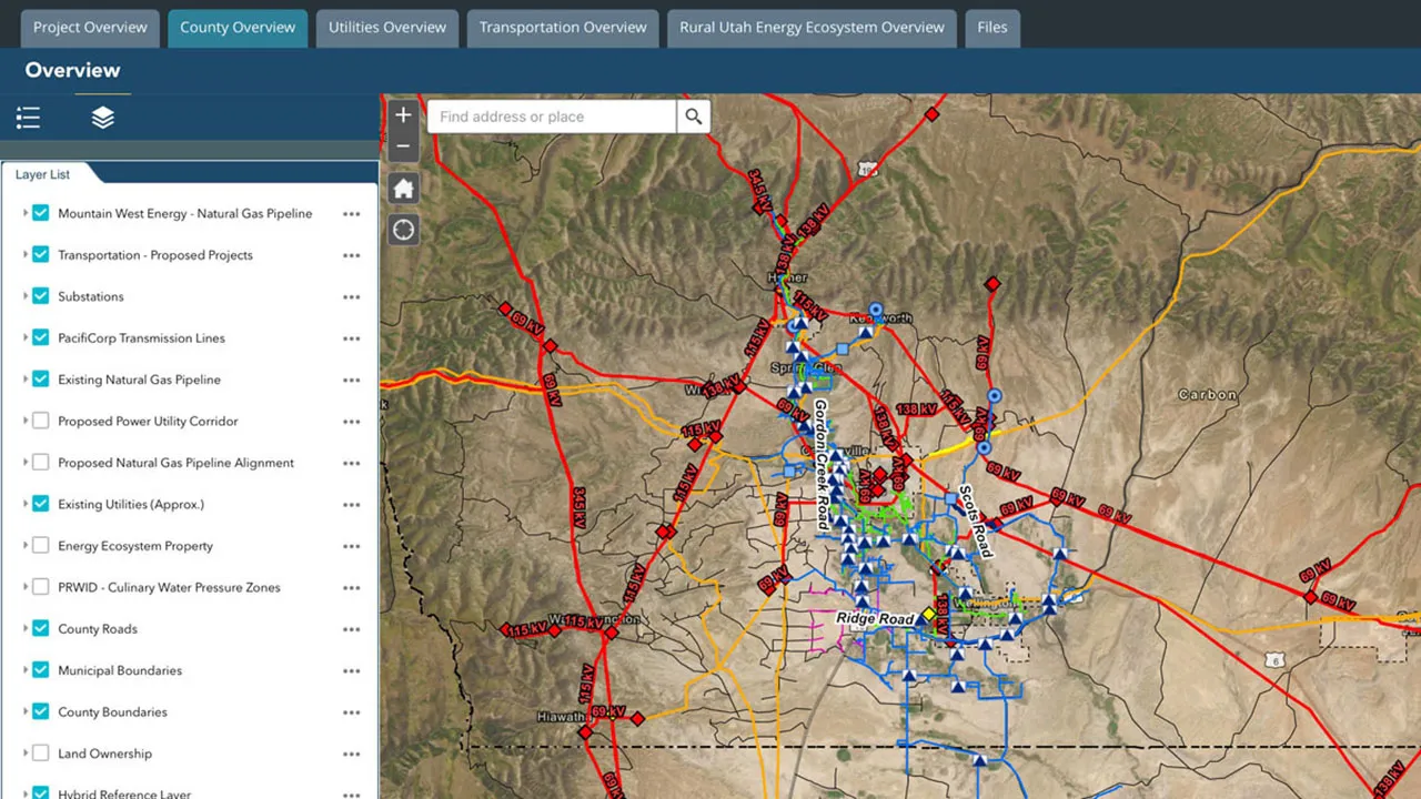
Carbon County Infrastructure Asset Planning
Price, UtahJones & DeMille Engineering evaluated infrastructure capacity across Carbon County and delivered a GIS-based platform to guide investment decisions and support long-term growth.

La Verkin City Master Transportation Plan
La Verkin, UtahJones & DeMille Engineering developed a master plan for La Verkin that balances rural character with growth, improving connectivity, mobility, and recreation through prioritized projects aligned with the City's general plan.
Laketown Planning Services
Laketown, UtahJones & DeMille Engineering partnered with Laketown to support long-range planning and development management—including a full Annexation Policy Plan update, subdivision review processes, and ongoing code maintenance through civiclinQ.
Monroe City Planning Services
Monroe, UtahJones & DeMille Engineering provides ongoing planning support for Monroe City—helping the community manage growth through annexation policy, subdivision and land use review, and municipal code management via civiclinQ.